
What life used to be like here
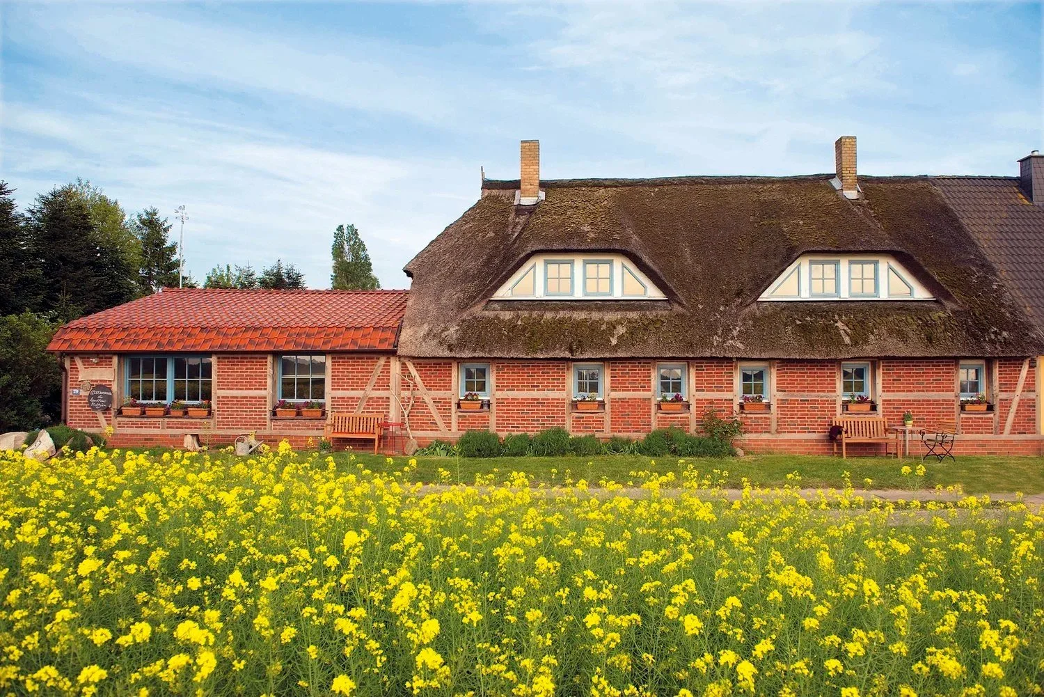
An old farmworkers’ cottage at the edge of the fields.
Our Landhaus was once a cottage belonging to the Maltzien estate: a house where the families lived who worked in the estate’s fields and farmyards. Old photographs like these show what the cottages with their low thatched roofs looked like back then.
The fields around the house are still there. Where farmworkers once lived, our guests now stay, in four holiday apartments named after the small islands around Rügen.
The estate families
For centuries the Maltzien estate belonged to the von Kahlden family, documented as early as the 16th century. Their coat of arms, a lion’s head, can still be seen on the manor house today.
In 1908 the heirs of Major Karl von Kahlden sold the estate to the farmer Max Venzmer: 335 hectares of land, plus the small island of Tollow, where sheep grazed. Venzmer died in 1932 and was buried on Tollow. His widow ran the estate until it was expropriated in the 1945 land reform.
Work and daily life
This was how it worked on many estates in north-eastern Germany: farmworkers lived with their whole family in a cottage owned by the estate, and usually husband, wife and the older children all worked.
Much of their pay came in kind, known as the Deputat: grain and potatoes, firewood, a patch of garden and often the right to keep a cow, a few pigs and chickens. In summer the day began at around five in the morning and only ended at sunset. At harvest time, seasonal workers – the reapers – came to help.
Zudar on old maps
The old structures can still be seen today.
When Rügen belonged to Sweden, the Swedish Crown had its land in Pomerania precisely surveyed. In 1695 the surveyor Oloff Spaak mapped the villages on Zudar – Buse, Zuder, Losentitz, Stakewitz and Maltzin – with every field, meadow and path.
If you look closely, you can recognise a lot: the bay, the little island of Tollow, the position of the village, and paths and field boundaries that can still be made out today.
An old Rügen travel guide later noted: “…the Zudar peninsula, too, is very fertile.”
Exploring around Zudar
Zudar, Rügen’s southernmost peninsula, was first mentioned as early as 1166.
St. Laurentius: Zudar’s old pilgrimage church, first mentioned in 1318.
Palmer Ort: Rügen’s southernmost point, with coastal protection forest and a nature trail. In winter the ice sometimes piles up metres high here.
Schoritzer Wiek: A nature reserve with an observation tower, cranes and the bird island of Tollow.
Beach: around 6 km of almost untouched coastline where you can find shells, hag stones and belemnite fossils.
Glewitz ferry: the short crossing over the Strelasund to Stahlbrode.
Fancy discovering it for yourself?
Zudar is small enough to explore by bike: Palmer Ort, the Schoritzer Wiek and St. Laurentius church are all on the peninsula.